
Peaks and Paths
Peaks and Paths is a working iPhone app for walking in hills. Everything it holds — the walks, the photographs, the notes and the planned walks — stays in the app’s own storage rather than on somebody else’s server, and the app can be put behind its own PIN.
The screen that justifies the app is the climb. Distance and pace do not describe a walk: eight flat kilometres along a canal and eight up Scafell Pike are the same number and nothing alike, and the whole difference is in the ascent. So every walk is broken down by gradient — level, rising, climbing, descending — with the seconds and the metres in each, the cumulative ascent and descent, the highest point reached, and a Naismith’s-rule estimate held up against the time it actually took.
It is careful about it. GPS altitude carries ten to fifteen metres of error, which is larger than most of the steps being measured, so the altitude is smoothed before any gradient is taken from it, a climb is only banked once the ground has genuinely turned, and each band is labelled on screen with the gradient behind it rather than implying a precision that is not there.
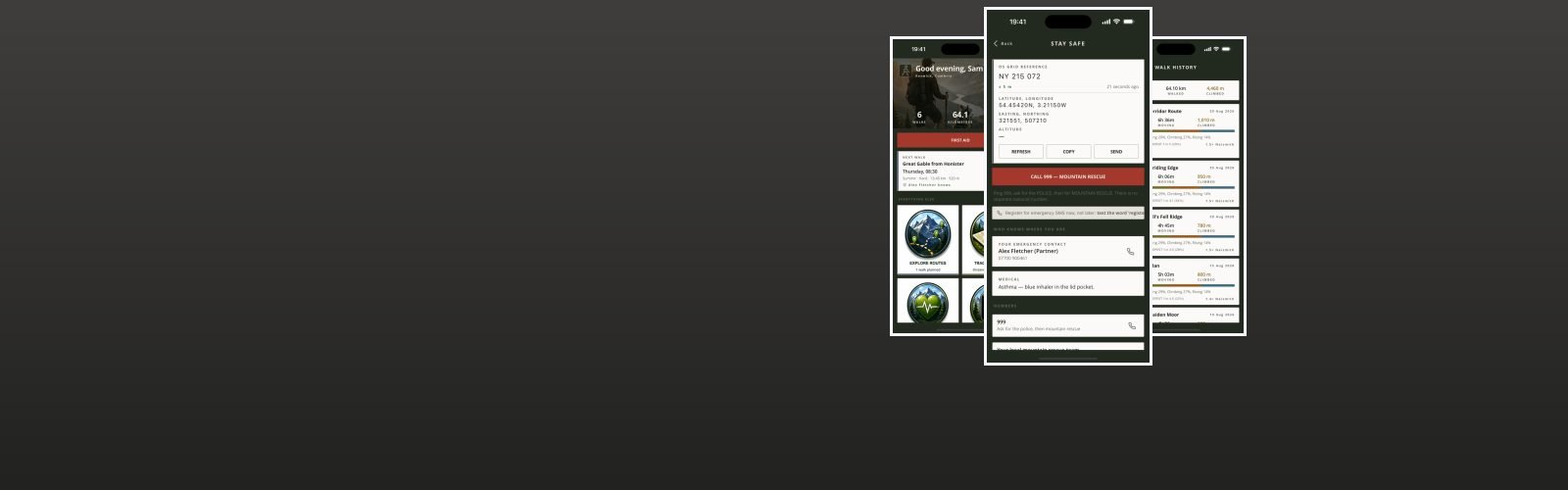
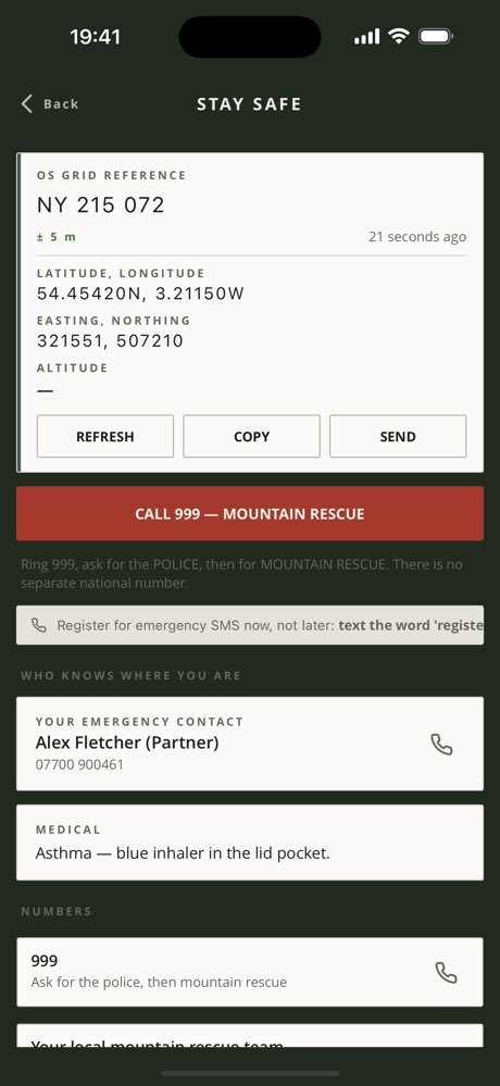
Where you are, in the form somebody asks for it. A six-figure British National Grid reference with its square letters, beside decimal latitude and longitude, with accuracy and altitude and a button to copy it. It is worked out on the phone with no network involved. Outside Great Britain it says so and shows degrees instead, because a grid reference for a Spanish hillside is a wrong answer rather than no answer. Beside it: who you left word with, where you said you were going, when you are due back, and a button to call them — plus a distress signal that flashes the torch six times a minute, the rhythm somebody looking for you is taught to watch for.
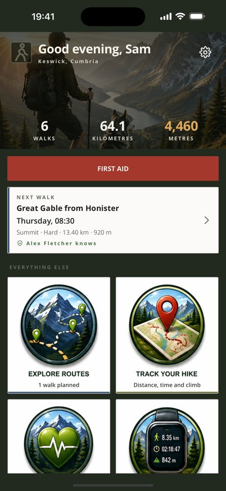
First aid is twenty-nine topics for walking and wilderness, hypothermia first, because it is the one that kills walkers in this country and because the traditional answers to it are actively harmful. Every topic says what it looks like, what to do and what not to do. It is guidance and not a substitute for 999, and it says so on screen.
- PlatformiPhone, portrait, iOS 15 and later
- StorageOn device only, PIN protected
- ScreensHome, plan, tracker, history, safety, first aid, gallery, notes, profile
- TrackingRuns while the app is open, and adopts a walk left behind by a force-quit

Free, and what a subscription unlocks
Tracking a walk is free, and so is everything you would want in an emergency. The safety screen — your grid reference, the person you left word with, and the distress signal — is free and is not a candidate for anything else. So is the whole first aid library, on principle: hypothermia does not wait for a payment screen.
A subscription unlocks the record-keeping — planning a walk in advance, the history of every walk you have done with its climb and gradient breakdown, the gallery of photographs and video, and the typed and spoken notes pinned to where you were standing. It comes in two lengths, monthly and quarterly, and the app shows the price for your country before you buy. It renews until you cancel it in the App Store.
Cancelling takes nothing off your phone. Your walks, their photographs and their notes stay exactly where they are; the paid screens simply stop opening.
The one piece of personal information involved is your email address, held so the subscription can be recognised as yours. See the privacy policy and the terms of use.
Every screen in the app
Five screens, three at a time — swipe, or use the arrows and dots. Tap a screenshot to see it full size.
Interested in an app like this, or in something else for iPhone, iPad or Android? Get in touch.